


Topic 3b - Ocean salinity
In this video, Dr Chris Banks tells us about ocean salinity and its impacts on the water cycle, ocean currents and the global climate.
Everyone knows the ocean is salty, but how salty it is varies depending on where you measure it. Input from rivers and rain can alter the oceans salinity, by adding fresh water.
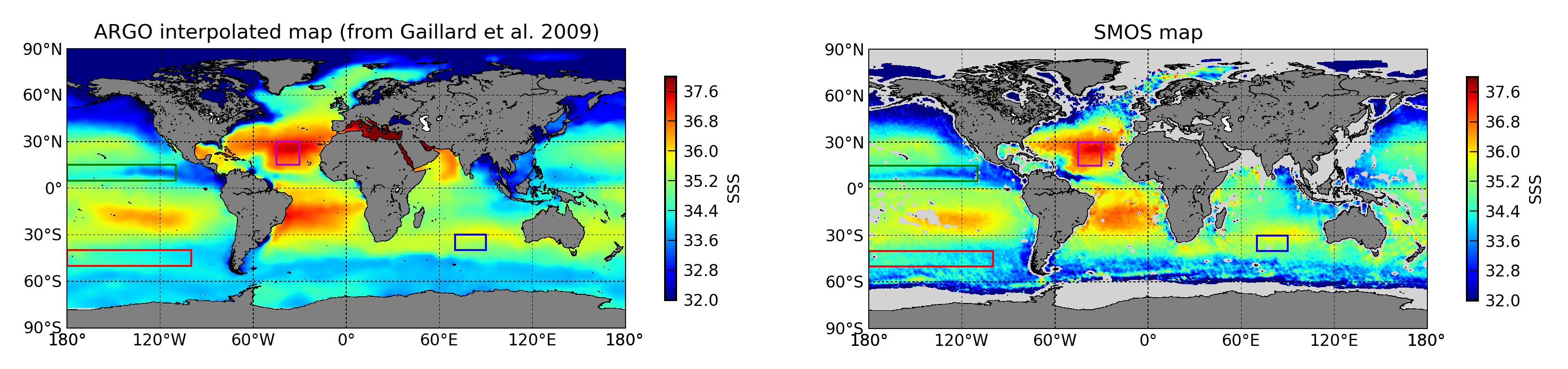
Salinity is an important variable for understanding the global, density driven, ocean circulation, known as the ‘Thermohaline” circulation. However it is a very new variable for satellite remote sensing, with the first sensor (SMOS) being launched in 2009. This is an innovative satellite, using 69 radiometers to produce salinity measurements globally.
It is hoped that this fascinating new data will be assimilated in to global ocean models to improve simulation of physical ocean dynamics. As well as measuring salinity, SMOS can also measure soil moisture and sea ice thickness – a true multitasking satellite!
Featured Educators:
- Dr Chris Banks
View featured satellites on the satellite tracking app
Don’t forget you can download the video and transcript with the links on the right.
Imagery

A map of surface salinity levels (between 32 and 38‰) recorded between August & September of 2010 and 2011 by the European Space Agency’s Soil Moisture and Ocean Salinity (SMOS) satellite, the first such satellite in the world
ESA


Five years of global sea-surface salinity from SMOS
ESA/Ifremer–N. Reul